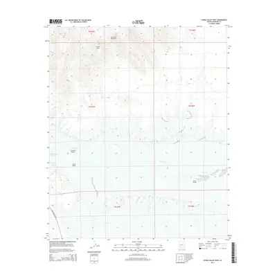
2014 Map of Citrus Valley West
USGS Topo · Published 2014About this map
Gila River drainage dominates the lower desert landscape of western Maricopa County, as captured in this 2014 survey. The topography is defined by the sharp transition between the alluvial Citrus Valley and the jagged elevation of the Gila Bend Mountains to the north, including the prominent Bunyan Peak. The southern portion of the map is significantly impacted by the hydrology of the Painted Rock Reservoir, with the Painted Rock Dam Rd providing access to this critical regional infrastructure. The map illustrates the dramatic path of the Gila River Canyon, where the water has carved through the arid terrain, creating a complex series of washes and ridges. This modern topographic study offers a precise view of the land management and natural boundaries within the Sonoran Desert, reflecting the enduring geographic importance of the Gila waterway.
Find a feature on this map
13 named features on this map. Tap any name to fly to it.
Don’t see what you’re looking for? This feature index may not catch every label — zoom into the map to look around manually.
Map Details
Editions of this 2014 Citrus Valley West Map
This is the sole edition of this map. No revisions or reprints were ever made.
Other maps of this area

1942 · Vicksburg
USGS Topo · 1:250,000

1949 · Sentinel
USGS Topo · 1:62,500

1950 · Sentinel
USGS Topo · 1:62,500

1950 · Theba
USGS Topo · 1:62,500

1951 · Theba
USGS Topo · 1:62,500

1951 · Dendora Valley
USGS Topo · 1:62,500

1951 · Woolsey Peak
USGS Topo · 1:62,500

1953 · Ajo
USGS Topo · 1:250,000

1954 · Phoenix
USGS Topo · 1:250,000

1957 · Ajo
USGS Topo · 1:250,000