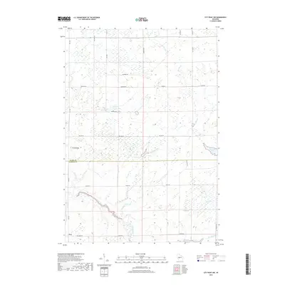
2018 Map of City Point NW
USGS Topo · Published 2018About this map
The East Fork Black River snakes through the southwestern corner of this map near the small settlement of Pray, defining a landscape where the Clark Co Jackson Co line divides dense marshland and creek systems. To the north, Brushy Ridge rises above a network of water bodies, including L-95 Reservoir and Washburn Pond, reflecting the water-heavy character of this central Wisconsin region. The drainage patterns are intricate, with Schumann Cr, Hay Meadow Cr, and Knutes Cr feeding into the larger river system. In the eastern portion of the quadrangle, Sherwood Lake and the wide Ammundson Marsh illustrate the transition between open water and wetland. This 2018 survey captures the area's rural road grid, where routes like Co Hwy K and Sherwood Rd navigate around the natural obstacles of the Black River watershed.
Find a feature on this map
32 named features on this map. Tap any name to fly to it.
Don’t see what you’re looking for? This feature index may not catch every label — zoom into the map to look around manually.
Map Details
Editions of this 2018 City Point NW Map
This is the sole edition of this map. No revisions or reprints were ever made.
Other maps of this area

1953 · Neillsville
USGS Topo · 1:62,500

1953 · Eau Claire
USGS Topo · 1:250,000

1954 · Granton
USGS Topo · 1:62,500

1957 · City Point
USGS Topo · 1:48,000

1958 · Eau Claire
USGS Topo · 1:250,000

1958 · Hatfield
USGS Topo · 1:48,000

1964 · Eau Claire
USGS Topo · 1:250,000

1970 · City Point NE
USGS Topo · 1:24,000

1970 · Spaulding
USGS Topo · 1:24,000
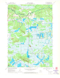
1970 · City Point
USGS Topo · 1:24,000