
1970 Map of City Point NE
USGS Topo · Published 1972About this map
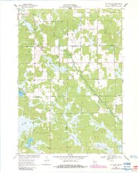
Sherwood and Nevins anchor this 1970 landscape, where the agricultural grid meets the extensive wetlands of Central Wisconsin. The East Fork Black River and Rocky Run wind through the terrain, feeding into a complex system of marshes including Ammundson Marsh, Rattlesnake Marsh, and Lyman Marsh. A notable local landmark is Sherwood Lake with its adjacent County Park, serving as a focal point for recreation in this tri-county border region.
Find a feature on this map
34 named features on this map. Tap any name to fly to it.
Don’t see what you’re looking for? This feature index may not catch every label — zoom into the map to look around manually.
Map Details
Editions of this 1970 City Point NE Map
2 editions found
Other maps of this area

1953 · Eau Claire
USGS Topo · 1:250,000

1954 · Granton
USGS Topo · 1:62,500

1954 · Marshfield
USGS Topo · 1:62,500

1957 · Pittsville
USGS Topo · 1:48,000

1957 · City Point
USGS Topo · 1:48,000

1958 · Eau Claire
USGS Topo · 1:250,000

1964 · Eau Claire
USGS Topo · 1:250,000

1967 · Pittsville
USGS Topo · 1:62,500

1970 · Spaulding
USGS Topo · 1:24,000
1970 · City Point
USGS Topo · 1:24,000