
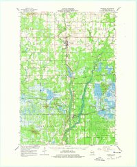
1967 Map of Pittsville
USGS Topo · Published 1969About this map
The Yellow River flows through the heart of Wood County, anchoring a landscape defined by extensive wetlands and the specialized agriculture of the mid-1960s. This survey records a transition from the agricultural hub of Pittsville to the vast water management systems of the Cranmoor region, where numerous Cranberry Bogs and specialized water bodies like Lake Dexter dominate the terrain. The southern portion of the sheet is largely dedicated to the State Wildlife Demonstration Area, featuring a complex network of managed flowages including North Gallagher, Quail Point, and Bullgrass Flowage.
Find a feature on this map
73 named features on this map. Tap any name to fly to it.
Don’t see what you’re looking for? This feature index may not catch every label — zoom into the map to look around manually.
Map Details
Editions of this 1967 Pittsville Map
2 editions found
Other maps of this area

1953 · Eau Claire
USGS Topo · 1:250,000

1954 · Granton
USGS Topo · 1:62,500

1954 · Marshfield
USGS Topo · 1:62,500

1955 · Green Bay
USGS Topo · 1:250,000

1956 · Milladore
USGS Topo · 1:48,000

1957 · Wisconsin Rapids
USGS Topo · 1:48,000

1957 · Pittsville
USGS Topo · 1:48,000

1957 · City Point
USGS Topo · 1:48,000

1958 · Eau Claire
USGS Topo · 1:250,000

1958 · Arkdale
USGS Topo · 1:48,000