
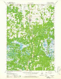
1957 Map of Pittsville
USGS Topo · Published 1959About this map
The Yellow River winds through the heart of Wood County, anchoring a landscape defined by its specialized agricultural and industrial heritage. During the late 1950s, the region around Pittsville and Babcock shows a distinct concentration of Cranberry Bogs and sand excavations, illustrating the unique drainage and soil requirements of the central Wisconsin marshlands. The Chicago Milwaukee St Paul and Pacific railroad cuts a diagonal line across the terrain, serving these rural outposts and the cranberry industry.
Find a feature on this map
43 named features on this map. Tap any name to fly to it.
Don’t see what you’re looking for? This feature index may not catch every label — zoom into the map to look around manually.
Map Details
Editions of this 1957 Pittsville Map
2 editions found
Other maps of this area

1953 · Eau Claire
USGS Topo · 1:250,000

1954 · Granton
USGS Topo · 1:62,500

1954 · Marshfield
USGS Topo · 1:62,500

1955 · Green Bay
USGS Topo · 1:250,000

1956 · Milladore
USGS Topo · 1:48,000

1957 · Wisconsin Rapids
USGS Topo · 1:48,000

1957 · City Point
USGS Topo · 1:48,000

1958 · Eau Claire
USGS Topo · 1:250,000

1958 · Arkdale
USGS Topo · 1:48,000

1958 · Necedah
USGS Topo · 1:48,000