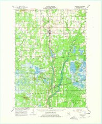
1967 Map of Pittsville
USGS Topo · Published 1978About this map
The Yellow River winds through the heart of Wood County, anchoring a landscape defined by the intersection of early industry and wildlife conservation. In Pittsville, the city grid sits just north of the sewage disposal site, while further south, Dexterville marks the shores of Lake Dexter. This mid-century survey reveals a highly managed hydrological system, particularly within the Sandhill State Wildlife Demonstration Area, where a series of artificial pools like East Potts Flowage and Bullgrass Flowage illustrate the conversion of wetlands for conservation and flood control.
Find a feature on this map
72 named features on this map. Tap any name to fly to it.
Don’t see what you’re looking for? This feature index may not catch every label — zoom into the map to look around manually.
Map Details
Editions of this 1967 Pittsville Map
2 editions found

Other maps of this area

1953 · Eau Claire
USGS Topo · 1:250,000

1954 · Granton
USGS Topo · 1:62,500

1954 · Marshfield
USGS Topo · 1:62,500

1955 · Green Bay
USGS Topo · 1:250,000

1956 · Milladore
USGS Topo · 1:48,000

1957 · Wisconsin Rapids
USGS Topo · 1:48,000

1957 · Pittsville
USGS Topo · 1:48,000

1957 · City Point
USGS Topo · 1:48,000

1958 · Eau Claire
USGS Topo · 1:250,000

1958 · Arkdale
USGS Topo · 1:48,000