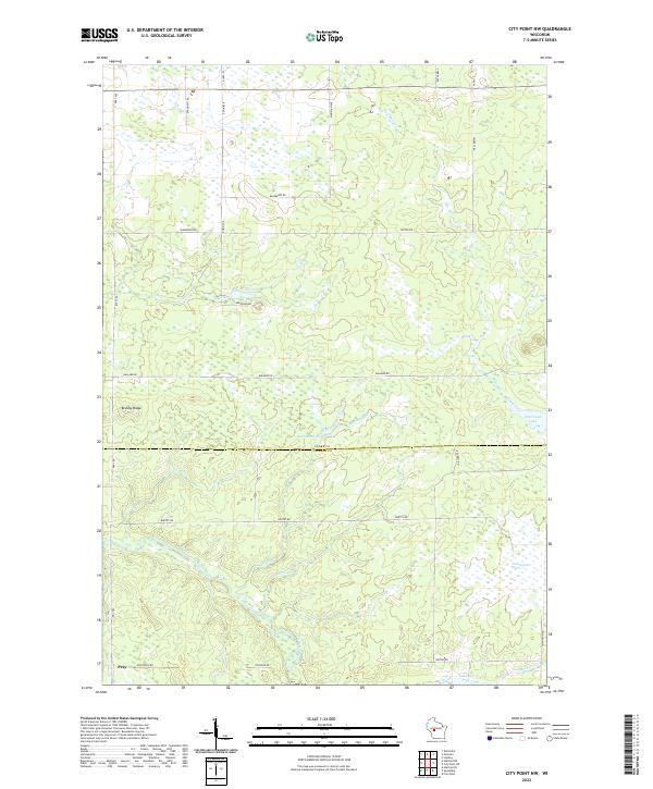
2022 Map of City Point NW
USGS Topo · Published 2022About this map
The low-lying wetlands of the Clark and Jackson County line dominate this landscape, where the East Fork Black River carves a winding path through the southern townships. The settlement of Pray sits at a crossroads in the southwest, serving as a primary point of reference in an area characterized by extensive marshes and seasonal water bodies. The geography is defined by complex drainage systems, including Hay Meadow Cr and Schumann Cr, which feed into larger features like Sherwood Lake and the Ammundson Marsh. Local land use is reflected in features such as the 1-95 Reservoir and Washwood Pond, while prominent high ground like Brushy Ridge provides rare relief in the otherwise level terrain. The network of rural routes, including Pray Rd and Ballard Rd, provides access through the expansive timber and wetland tracts of central Wisconsin.
Find a feature on this map
38 named features on this map. Tap any name to fly to it.
Don’t see what you’re looking for? This feature index may not catch every label — zoom into the map to look around manually.
Map Details
Editions of this 2022 City Point NW Map
This is the sole edition of this map. No revisions or reprints were ever made.
Other maps of this area

1953 · Neillsville
USGS Topo · 1:62,500

1953 · Eau Claire
USGS Topo · 1:250,000

1954 · Granton
USGS Topo · 1:62,500

1957 · City Point
USGS Topo · 1:48,000

1958 · Eau Claire
USGS Topo · 1:250,000

1958 · Hatfield
USGS Topo · 1:48,000

1964 · Eau Claire
USGS Topo · 1:250,000

1970 · City Point NE
USGS Topo · 1:24,000

1970 · Spaulding
USGS Topo · 1:24,000
1970 · City Point
USGS Topo · 1:24,000