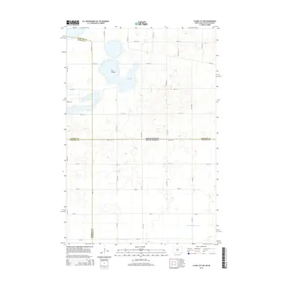
2014 Map of Claire City NW
USGS Topo · Published 2014About this map
The North Dakota-South Dakota border bisects this prairie landscape, where the agricultural grid meets the distinct hydrology of the Glacial Lake Agassiz region. In the northern half, located in Sargent and Richland counties, the massive depression of Park Lakebed and the adjacent Kennedy Slough dominate the terrain. These features reflect the post-glacial drainage patterns common to this corner of the Great Plains, where many historic water bodies have transitioned into seasonal sloughs or dry lakebeds. The presence of Bergen Cem on the western edge of the quadrangle serves as a quiet marker of the early Scandinavian settlement that defined the region's homesteading era.
Find a feature on this map
33 named features on this map. Tap any name to fly to it.
Don’t see what you’re looking for? This feature index may not catch every label — zoom into the map to look around manually.
Map Details
Editions of this 2014 Claire City NW Map
This is the sole edition of this map. No revisions or reprints were ever made.
Other maps of this area

1907 · Wyndmere
USGS Topo · 1:125,000

1953 · Milbank
USGS Topo · 1:250,000

1953 · Fargo
USGS Topo · 1:250,000

1956 · Fargo
USGS Topo · 1:250,000

1958 · Milbank
USGS Topo · 1:250,000

1958 · Veblen
USGS Topo · 1:24,000

1958 · Veblen NE
USGS Topo · 1:24,000

1958 · Geneseo
USGS Topo · 1:24,000
1964 · Lidgerwood
USGS Topo · 1:24,000
1964 · Swan Lake
USGS Topo · 1:24,000