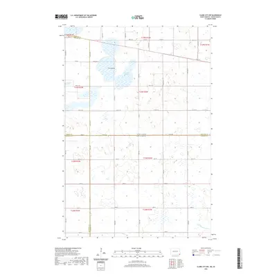
2020 Map of Claire City NW
USGS Topo · Published 2020About this map
Little Minnesota River begins its course in the southeastern corner of this quadrangle, a vital waterway within a landscape defined by complex jurisdictional boundaries and glacial hydrology. The map captures the intersection of four counties across the North Dakota and South Dakota border: Richland, Sargent, Marshall, and Roberts. This rural expanse is characterized by significant depressions and ephemeral water bodies, most notably the wide Park Lakebed and the nearby Kennedy Slough. A strictly oriented grid of section-line roads, including 98th St SE and 101st St SE, provides the primary infrastructure for the scattered farmsteads and agricultural operations that populate these prairie townships.
Find a feature on this map
25 named features on this map. Tap any name to fly to it.
Don’t see what you’re looking for? This feature index may not catch every label — zoom into the map to look around manually.
Map Details
Editions of this 2020 Claire City NW Map
This is the sole edition of this map. No revisions or reprints were ever made.
Other maps of this area

1907 · Wyndmere
USGS Topo · 1:125,000

1953 · Milbank
USGS Topo · 1:250,000

1953 · Fargo
USGS Topo · 1:250,000

1956 · Fargo
USGS Topo · 1:250,000

1958 · Milbank
USGS Topo · 1:250,000

1958 · Veblen
USGS Topo · 1:24,000

1958 · Veblen NE
USGS Topo · 1:24,000

1958 · Geneseo
USGS Topo · 1:24,000
1964 · Lidgerwood
USGS Topo · 1:24,000
1964 · Swan Lake
USGS Topo · 1:24,000