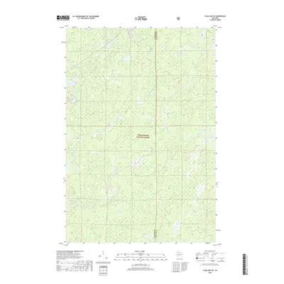
2018 Map of Clam Lake SW
USGS Topo · Published 2018About this map
Chequamegon National Forest encompasses this section of the Northwoods, where the border of Sawyer and Ashland counties runs through a dense network of glacial lakes and river systems. The West Fork Chippewa River and the Torch River drain the northern reaches of the quadrangle, while the Little Moose River and Moose River wind through the central and southern portions. This 2018 survey illustrates the complex hydrology of the region, including smaller water bodies like Cattail Lake, Ike Lake, and Kelly Lake. The presence of numerous creeks such as Fishtrap Cr and Black Cr highlights the intricate drainage patterns that characterize this forested landscape, which remains largely undeveloped and defined by its natural water features.
Find a feature on this map
14 named features on this map. Tap any name to fly to it.
Don’t see what you’re looking for? This feature index may not catch every label — zoom into the map to look around manually.
Map Details
Editions of this 2018 Clam Lake SW Map
This is the sole edition of this map. No revisions or reprints were ever made.
Other maps of this area

1942 · Clam Lake
USGS Topo · 1:48,000

1943 · Namekagon Lake
USGS Topo · 1:48,000

1944 · Draper
USGS Topo · 1:48,000

1944 · Radisson
USGS Topo · 1:48,000

1945 · Namekagon Lake
USGS Topo · 1:48,000

1945 · Clam Lake
USGS Topo · 1:48,000

1947 · Draper
USGS Topo · 1:48,000

1949 · Radisson
USGS Topo · 1:48,000

1953 · Ashland
USGS Topo · 1:250,000

1953 · Rice Lake
USGS Topo · 1:250,000