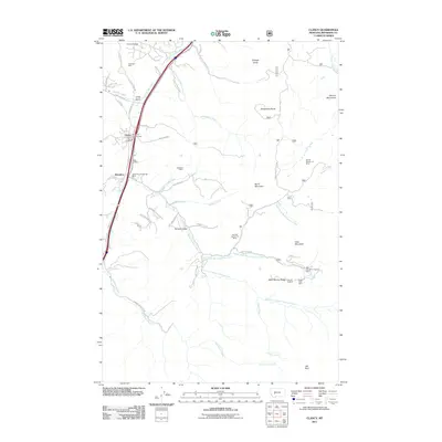
2011 Map of Clancy
USGS Topo · Published 2011About this map
Clancy and the surrounding drainages in Jefferson County exhibit a landscape defined by its mining heritage and rugged terrain at the eastern edge of the Elkhorn Mountains. The map reveals a high density of mineral claims and named shafts, such as the Champion Mine and the Argonaut Mine, scattered across the gulches north and south of the primary settlement. The community of Alhambra is noted for the Alhambra Hot Springs Mine, while the central hub of activity remains near the Clancy Post Office and Clancy Vol Fire Company.
Find a feature on this map
63 named features on this map. Tap any name to fly to it.
Don’t see what you’re looking for? This feature index may not catch every label — zoom into the map to look around manually.
Map Details
Editions of this 2011 Clancy Map
This is the sole edition of this map. No revisions or reprints were ever made.
Other maps of this area

1886 · Fort Logan
USGS Topo · 1:250,000

1889 · Helena
USGS Topo · 1:250,000

1893 · Helena
USGS Topo · 1:250,000

1899 · Boulder
USGS Topo · 1:125,000

1899 · Helena
USGS Topo · 1:62,500

1899 · Helena
USGS Topo · 1:250,000

1903 · Helena
USGS Topo · 1:250,000

1947 · Butte
USGS Topo · 1:250,000

1948 · White Sulphur Springs
USGS Topo · 1:250,000

1950 · Jefferson City
USGS Topo · 1:62,500