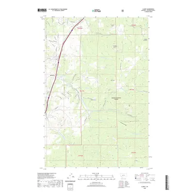
2020 Map of Clancy
USGS Topo · Published 2020About this map
Clancy and the neighboring settlement of Alhambra sit at the western edge of the Elkhorn Mountains, where the modern corridor of the BNSF Railway follows the path of Prickly Pear Cr. This area of Jefferson County reflects a landscape defined by significant drainage systems, including Lump Gulch, Warm Springs Cr, and McClellan Cr, which carve through the high terrain. To the east, the Helena National Forest encompasses prominent peaks such as Lava Mtn, Burnt Mtn, and the distinctive Strawberry Butte. The southern reaches of the map transition into the high meadows of Elk Park, while ridges like Mike Murray Ridge and Sleeping Giant provide natural boundaries. Several named springs, such as 08N03W16AC_01 Spring, are noted near the communities, indicating the importance of local water sources in this mountainous region.
Find a feature on this map
72 named features on this map. Tap any name to fly to it.
Don’t see what you’re looking for? This feature index may not catch every label — zoom into the map to look around manually.
Map Details
Editions of this 2020 Clancy Map
This is the sole edition of this map. No revisions or reprints were ever made.
Other maps of this area

1886 · Fort Logan
USGS Topo · 1:250,000

1889 · Helena
USGS Topo · 1:250,000

1893 · Helena
USGS Topo · 1:250,000

1899 · Boulder
USGS Topo · 1:125,000

1899 · Helena
USGS Topo · 1:62,500

1899 · Helena
USGS Topo · 1:250,000

1903 · Helena
USGS Topo · 1:250,000

1947 · Butte
USGS Topo · 1:250,000

1948 · White Sulphur Springs
USGS Topo · 1:250,000

1950 · Jefferson City
USGS Topo · 1:62,500