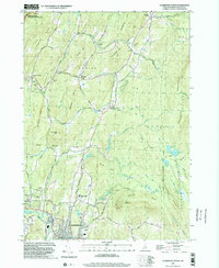
1998 Map of Claremont North
USGS Topo · Published 2002About this map
The Saint Gaudens National Historic Site anchors the northwestern corner of this Sullivan County landscape, preserving the home and studios of the famed sculptor. Moving southeast from the Connecticut River valley, the terrain rises toward Croydon Mountain and Green Mtn, revealing a classic New Hampshire pattern of small hamlets like Cornish Flat and Cornish Mills. These settlements are linked by historic routes such as Turnpike Rd and Town House Rd, with the landscape dotted by family-named cemeteries including Edminster Cem and Child Cem.
Find a feature on this map
64 named features on this map. Tap any name to fly to it.
Don’t see what you’re looking for? This feature index may not catch every label — zoom into the map to look around manually.
Map Details
Editions of this 1998 Claremont North Map
This is the sole edition of this map. No revisions or reprints were ever made.
Other maps of this area

1902 · Sunapee
USGS Topo · 1:62,500

1905 · Sunapee
USGS Topo · 1:62,500

1906 · Hanover
USGS Topo · 1:62,500

1907 · Sunapee
USGS Topo · 1:62,500

1908 · Hanover
USGS Topo · 1:62,500

1926 · Claremont
USGS Topo · 1:62,500

1927 · Mascoma
USGS Topo · 1:62,500

1929 · Claremont
USGS Topo · 1:62,500

1932 · Mascoma
USGS Topo · 1:62,500

1950 · Glens Falls
USGS Topo · 1:250,000