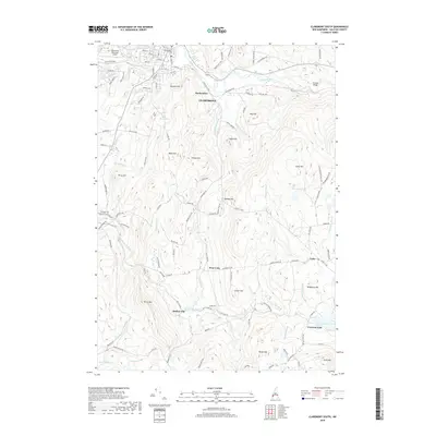
2018 Map of Claremont South
USGS Topo · Published 2018About this map
The Sugar River valley and its surrounding highlands define this portion of Sullivan County, where the industrial edges of Claremont give way to smaller rural settlements. The northern portion of the map is anchored by Claremont Municipal Airport and the neighborhood of Puckershire, while the Wrights Bridge crossing marks a key point on the river to the east. The terrain rises sharply toward Unity Mtn and Bible Hill, creating a landscape defined by steep drainages like Gully Brook and Hubbard Brook.
Find a feature on this map
120 named features on this map. Tap any name to fly to it.
Don’t see what you’re looking for? This feature index may not catch every label — zoom into the map to look around manually.
Map Details
Editions of this 2018 Claremont South Map
This is the sole edition of this map. No revisions or reprints were ever made.
Other maps of this area

1902 · Sunapee
USGS Topo · 1:62,500

1905 · Sunapee
USGS Topo · 1:62,500

1907 · Sunapee
USGS Topo · 1:62,500

1926 · Claremont
USGS Topo · 1:62,500

1927 · Bellows Falls
USGS Topo · 1:48,000

1929 · Claremont
USGS Topo · 1:62,500

1930 · Lovewell Mountain
USGS Topo · 1:62,500

1930 · Bellows Falls
USGS Topo · 1:62,500

1942 · Lovewell Mountain
USGS Topo · 1:62,500

1950 · Glens Falls
USGS Topo · 1:250,000