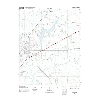
2013 Map of Claremore
USGS Topo · Published 2013About this map
Claremore Lake anchors the northern portion of this Rogers County landscape, serving as a focal point for the surrounding residential developments and rural road networks. The 2013 terrain is defined by a series of small water bodies and creeks, including Happy Lake, Petersons Lake, and the meandering paths of Dog Cr and Panther Cr. Long-established community centers are marked by significant local landmarks such as Woodlawn Cem and Talber Cem, which offer essential records for genealogical research in the area.
Find a feature on this map
141 named features on this map. Tap any name to fly to it.
Don’t see what you’re looking for? This feature index may not catch every label — zoom into the map to look around manually.
Map Details
Editions of this 2013 Claremore Map
This is the sole edition of this map. No revisions or reprints were ever made.
Other maps of this area

1896 · Pryor
USGS Topo · 1:125,000

1901 · Claremore
USGS Topo · 1:125,000

1901 · Pryor
USGS Topo · 1:125,000

1914 · Claremore
USGS Topo · 1:125,000

1916 · Claremore
USGS Topo · 1:125,000

1954 · Tulsa
USGS Topo · 1:250,000

1958 · Tulsa
USGS Topo · 1:250,000

1963 · Tulsa
USGS Topo · 1:250,000
1963 · Sageeyah
USGS Topo · 1:24,000
1963 · Catoosa
USGS Topo · 1:24,000