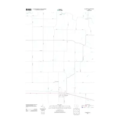
2013 Map of Clarence
USGS Topo · Published 2013About this map
The town of Clarence serves as the primary hub of this eastern Iowa landscape, situated at the intersection of local routes like Oxford Junction Rd and 1st Ave. The northern territory is defined by the winding course of the Wapsipinicon River, which provides recreation at the Jungletown Public Access. This area maintains its agricultural character through a dense grid of township roads, including the notable boundary of Cedar Jones Rd. Hydrology is central to the local geography, with several named tributaries such as Mill Cr, Plum Cr, and Yankee Run carving through the countryside. A significant local landmark, the Mill Creek Bridge, spans the water north of the main settlement. The map illustrates a well-organized rural infrastructure where modern survey lines follow historical land divisions, supporting the farming economy of Cedar County.
Find a feature on this map
47 named features on this map. Tap any name to fly to it.
Don’t see what you’re looking for? This feature index may not catch every label — zoom into the map to look around manually.
Map Details
Editions of this 2013 Clarence Map
This is the sole edition of this map. No revisions or reprints were ever made.
Other maps of this area

1889 · Tipton
USGS Topo · 1:62,500

1890 · Tipton
USGS Topo · 1:62,500

1891 · Monticello
USGS Topo · 1:62,500

1891 · Baldwin
USGS Topo · 1:62,500

1892 · Wheatland
USGS Topo · 1:62,500

1894 · Wheatland
USGS Topo · 1:62,500

1900 · Anamosa
USGS Topo · 1:125,000

1901 · Peosta
USGS Topo · 1:125,000

1901 · Rock Island
USGS Topo · 1:125,000

1901 · Stanwood
USGS Topo · 1:125,000