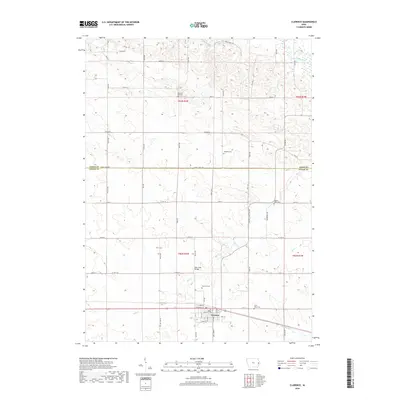
2018 Map of Clarence
USGS Topo · Published 2018About this map
Clarence serves as the principal hub of this agricultural landscape along the southern border of the Jones Co Cedar Co line. The town's grid is well-defined by local thoroughfares such as Smith St, Lombard St, and Ball St, indicating a structured rural center serving the surrounding farmsteads. The northern portion of the map is dominated by the meandering course of the Wapsipinicon River, while the southern reaches are drained by several smaller waterways, including Yankee Run and Mill Cr.
Find a feature on this map
33 named features on this map. Tap any name to fly to it.
Don’t see what you’re looking for? This feature index may not catch every label — zoom into the map to look around manually.
Map Details
Editions of this 2018 Clarence Map
This is the sole edition of this map. No revisions or reprints were ever made.
Other maps of this area

1889 · Tipton
USGS Topo · 1:62,500

1890 · Tipton
USGS Topo · 1:62,500

1891 · Monticello
USGS Topo · 1:62,500

1891 · Baldwin
USGS Topo · 1:62,500

1892 · Wheatland
USGS Topo · 1:62,500

1894 · Wheatland
USGS Topo · 1:62,500

1900 · Anamosa
USGS Topo · 1:125,000

1901 · Peosta
USGS Topo · 1:125,000

1901 · Rock Island
USGS Topo · 1:125,000

1901 · Stanwood
USGS Topo · 1:125,000