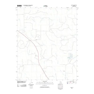
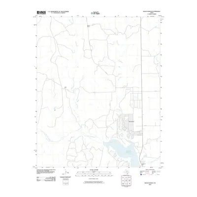
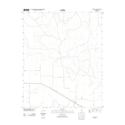
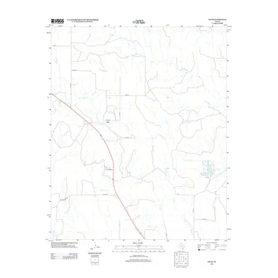
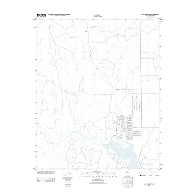
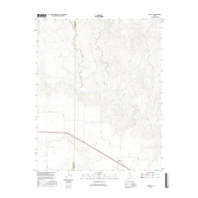
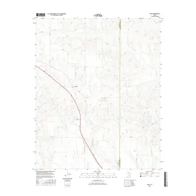
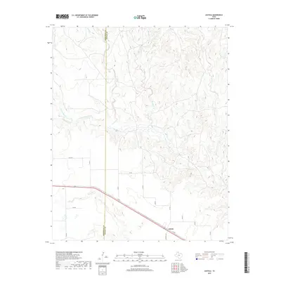
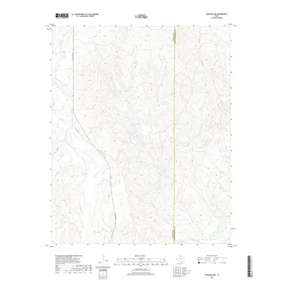
1963 Map of Clarendon SW
USGS Topo · Published 1966About this map
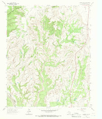
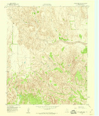
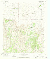
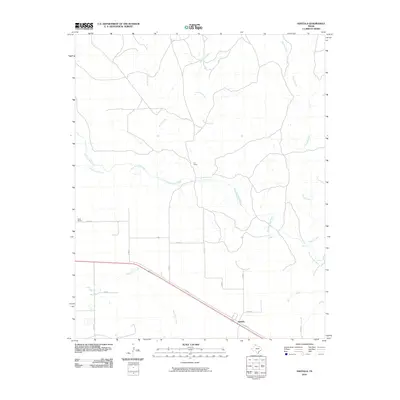
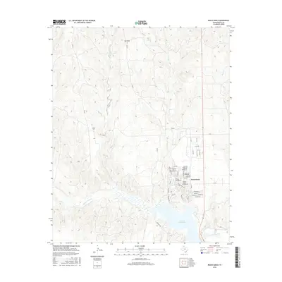
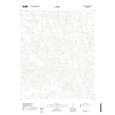
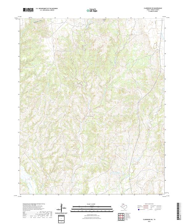
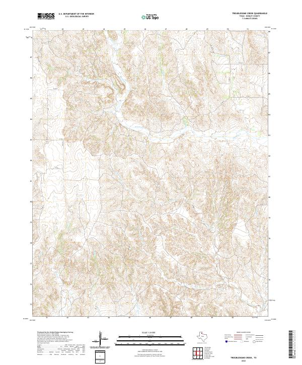
Gunboat Mountain rises above a landscape defined by an intricate network of drainage systems in this southwest portion of Donley County. The terrain is deeply dissected by numerous watercourses, most notably the confluence areas of Big Sandy Creek, Cottonwood Creek, and Sandy Creek. To the south, Mulberry Creek snakes through the lower elevations, while Troublesome Canyon and Troublesome Creek dominate the northern reaches. Surveyed in the early 1960s, the map reveals a largely rural ranching environment, where fine red dashed lines denote established fence lines across the breaks. The limited human footprint is centered on Highway 70, the primary corridor through this complex topography of ridges and creek beds.
Find a feature on this map
10 named features on this map. Tap any name to fly to it.
Don’t see what you’re looking for? This feature index may not catch every label — zoom into the map to look around manually.
Map Details
Editions of this 1963 Clarendon SW Map
This is the sole edition of this map. No revisions or reprints were ever made.
Historical Maps of Donley County Through Time
72 maps found
1959 Lelia Lake Creek
Donley County, TX
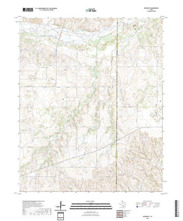
1959 McKnight
Donley County, TX
1959 Spencer Lake
Donley County, TX
1959 Troublesome Creek
Donley County, TX
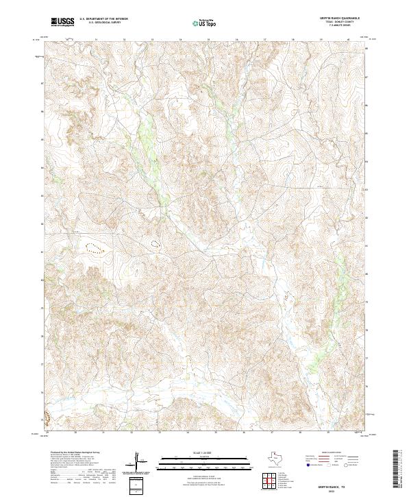
1962 Griffin Ranch
Donley County, TX
1962 Roach Ranch
Donley County, TX
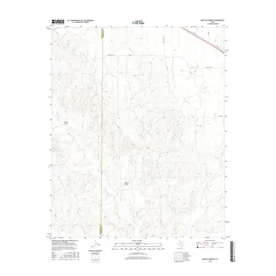
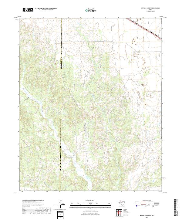
1963 Buffalo Arroyo
Donley County, TX
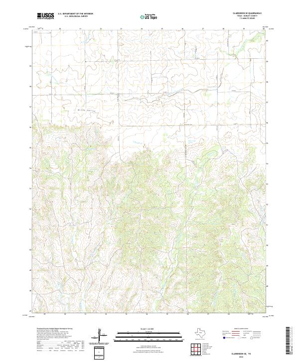
1963 Clarendon SE
Donley County, TX
1963 Clarendon SW
Donley County, TX
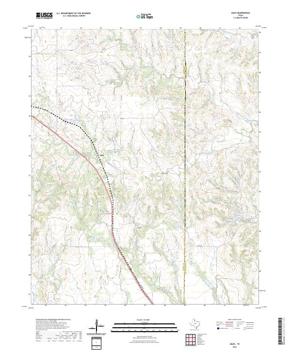
1963 Giles
Donley County, TX
1963 Tate Arroyo
Donley County, TX
1983 Ashtola
Donley County, TX
2010 Ashtola
Donley County, TX
2010 Buffalo Arroyo
Donley County, TX
2010 Clarendon SE
Donley County, TX
2010 Clarendon SW
Donley County, TX
2010 Giles
Donley County, TX
2010 Griffin Ranch
Donley County, TX
2010 Lelia Lake Creek
Donley County, TX
2010 McKnight
Donley County, TX
2010 Roach Ranch
Donley County, TX
2010 Spencer Lake
Donley County, TX
2010 Tate Arroyo
Donley County, TX
2010 Troublesome Creek
Donley County, TX
2012 Ashtola
Donley County, TX
2012 Buffalo Arroyo
Donley County, TX
2012 Clarendon SE
Donley County, TX
2012 Clarendon SW
Donley County, TX
2012 Giles
Donley County, TX
2012 Griffin Ranch
Donley County, TX
2012 Lelia Lake Creek
Donley County, TX
2012 McKnight
Donley County, TX
2012 Roach Ranch
Donley County, TX
2012 Spencer Lake
Donley County, TX
2012 Tate Arroyo
Donley County, TX
2012 Troublesome Creek
Donley County, TX
2016 Ashtola
Donley County, TX
2016 Buffalo Arroyo
Donley County, TX
2016 Clarendon SE
Donley County, TX
2016 Clarendon SW
Donley County, TX
2016 Giles
Donley County, TX
2016 Griffin Ranch
Donley County, TX
2016 Lelia Lake Creek
Donley County, TX
2016 McKnight
Donley County, TX
2016 Roach Ranch
Donley County, TX
2016 Spencer Lake
Donley County, TX
2016 Tate Arroyo
Donley County, TX
2016 Troublesome Creek
Donley County, TX
2019 Ashtola
Donley County, TX
2019 Buffalo Arroyo
Donley County, TX

2019 Clarendon SE
Donley County, TX
2019 Clarendon SW
Donley County, TX
2019 Giles
Donley County, TX
2019 Griffin Ranch
Donley County, TX
2019 Lelia Lake Creek
Donley County, TX
2019 McKnight
Donley County, TX
2019 Roach Ranch
Donley County, TX
2019 Spencer Lake
Donley County, TX
2019 Tate Arroyo
Donley County, TX
2019 Troublesome Creek
Donley County, TX
2022 Ashtola
Donley County, TX
2022 Buffalo Arroyo
Donley County, TX
2022 Clarendon SE
Donley County, TX
2022 Clarendon SW
Donley County, TX
2022 Griffin Ranch
Donley County, TX
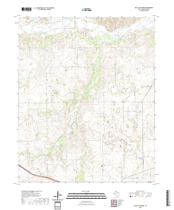
2022 Lelia Lake Creek
Donley County, TX
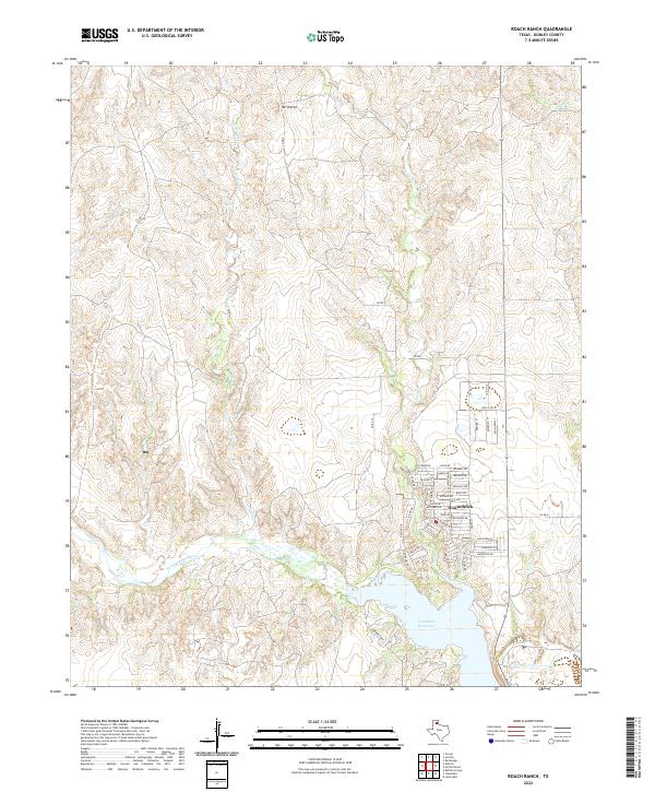
2022 Roach Ranch
Donley County, TX
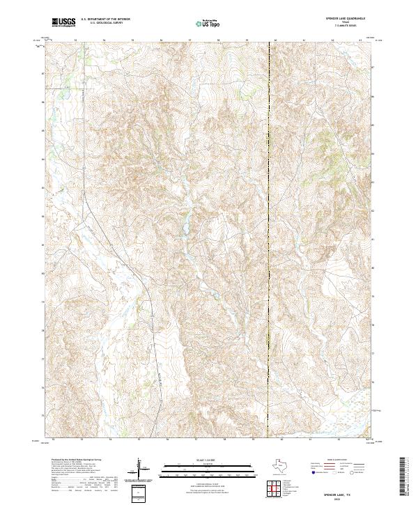
2022 Spencer Lake
Donley County, TX
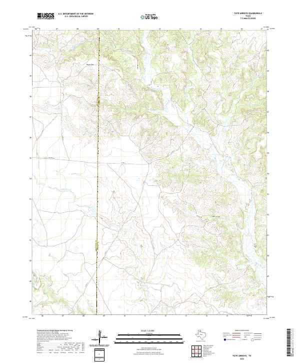
2022 Tate Arroyo
Donley County, TX
2022 Troublesome Creek
Donley County, TX
2023 Giles
Donley County, TX
2023 McKnight
Donley County, TX