
1963 Map of Clarendon
USGS Topo · Published 1966About this map
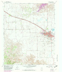
Clarendon serves as the focal point for this survey of the Texas Panhandle, situated where the Fort Worth and Denver railroad cuts across the plains. The town is depicted during a period of established civic growth, featuring prominent institutions like the Junior College and High Sch alongside the regional Rodeo Grounds. To the south and east, the landscape transitions from the residential grid of Browning Blvd and Thurman Ave into a cluster of memorial sites, including St Marys Cem, Odd Fellows Cem, and Citizens Cem. Outside the immediate town center, the terrain is defined by the drainage systems of Kelly Creek and Halls Creek, which carve through the breaks toward the southwest. The presence of Gunboat Mountain and the steep contours of Troublesome Canyon provide a sharp contrast to the level gravel pits and agricultural lands that dominate the surrounding Donley County countryside.
Find a feature on this map
36 named features on this map. Tap any name to fly to it.
Don’t see what you’re looking for? This feature index may not catch every label — zoom into the map to look around manually.
Map Details
Editions of this 1963 Clarendon Map
2 editions found
Other maps of this area

1954 · Amarillo
USGS Topo · 1:250,000

1954 · Plainview
USGS Topo · 1:250,000

1958 · Amarillo
USGS Topo · 1:250,000

1958 · Plainview
USGS Topo · 1:250,000

1960 · Groom
USGS Topo · 1:62,500

1962 · Lelia Lake
USGS Topo · 1:24,000

1962 · Roach Ranch
USGS Topo · 1:24,000

1962 · Griffin Ranch
USGS Topo · 1:24,000

1963 · Buffalo Arroyo
USGS Topo · 1:24,000

1963 · Clarendon SE
USGS Topo · 1:24,000