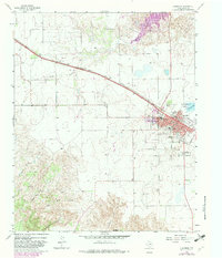
1963 Map of Clarendon
USGS Topo · Published 1982About this map
Clarendon serves as the focal point of this Donley County survey, situated at the intersection of the Fort Worth and Denver railroad and the regional highway system. The town's layout is clearly defined by historical thoroughfares like North Front St and Rosenfield St, while the outskirts are marked by a cluster of civic sites including St Marys Cem, Odd Fellows Cem, and Citizens Cem. The presence of a Junior College and a local High Sch underscores the community's role as an educational hub for the surrounding ranching and farming lands.
Find a feature on this map
33 named features on this map. Tap any name to fly to it.
Don’t see what you’re looking for? This feature index may not catch every label — zoom into the map to look around manually.
Map Details
Editions of this 1963 Clarendon Map
2 editions found
Other maps of this area

1954 · Amarillo
USGS Topo · 1:250,000

1954 · Plainview
USGS Topo · 1:250,000

1958 · Amarillo
USGS Topo · 1:250,000

1958 · Plainview
USGS Topo · 1:250,000

1960 · Groom
USGS Topo · 1:62,500

1962 · Lelia Lake
USGS Topo · 1:24,000

1962 · Roach Ranch
USGS Topo · 1:24,000

1962 · Griffin Ranch
USGS Topo · 1:24,000

1963 · Clarendon
USGS Topo · 1:24,000

1963 · Buffalo Arroyo
USGS Topo · 1:24,000