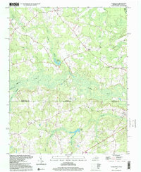
1997 Map of Claresville
USGS Topo · Published 2000About this map
The Virginia-North Carolina border bisects this landscape where the flat coastal plain is defined by an intricate network of wetlands and small agricultural communities. Small rural hubs like Claresville and Bryants Corner serve as anchors for the surrounding farmlands, connected by a web of local roads and an occasional Jeep Trail. The topography is dominated by sluggish waterways such as Fountains Creek and Cypress Creek, which feed into larger bodies like Jordans Millpond and Taylors Millpond. These millponds indicate a history of local water-powered industry in Greensville and Northampton counties. Faith and community life are centered on scattered country churches, including St Andrews Ch and Fountain Grove Ch, which remain prominent landmarks in the late 20th-century landscape. The Meherrin River cuts through the northeast corner, marking a significant drainage point for the surrounding swamps.
Find a feature on this map
22 named features on this map. Tap any name to fly to it.
Don’t see what you’re looking for? This feature index may not catch every label — zoom into the map to look around manually.
Map Details
Editions of this 1997 Claresville Map
This is the sole edition of this map. No revisions or reprints were ever made.
Other maps of this area

1919 · Emporia
USGS Topo · 1:62,500

1919 · Arringdale
USGS Topo · 1:48,000

1920 · Arringdale
USGS Topo · 1:62,500

1942 · Arringdale
USGS Topo · 1:62,500

1942 · Emporia
USGS Topo · 1:62,500

1953 · Norfolk
USGS Topo · 1:250,000

1963 · Skippers
USGS Topo · 1:24,000

1963 · Emporia
USGS Topo · 1:24,000
1966 · Drewryville
USGS Topo · 1:24,000

1966 · Margarettsville
USGS Topo · 1:24,000