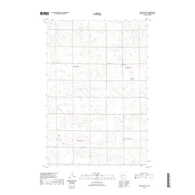
2020 Map of Clark Butte SW
USGS Topo · Published 2020About this map
Saint Placidus Cem and the surrounding rangeland along St Placidus Rd characterize this portion of Hettinger County. The landscape is defined by the winding course of Buffalo Cr, which cuts through the township boundaries of T136N and T135N. The section lines are clearly marked by a sparse network of gravel roads, including Newburg Rd and Burt Rd, connecting isolated homesteads and religious landmarks. For genealogists and local historians, the map provides precise locations for several denominational burial grounds, such as the Neuburg Congregational Cem and the Eichenfeld Baptist Cem. These sites reflect the early settlement patterns and community centers established by the various immigrant groups who farmed this high prairie region. The topographical data highlights the subtle but distinct drainage patterns and low buttes that define this corner of North Dakota.
Find a feature on this map
12 named features on this map. Tap any name to fly to it.
Don’t see what you’re looking for? This feature index may not catch every label — zoom into the map to look around manually.
Map Details
Editions of this 2020 Clark Butte SW Map
This is the sole edition of this map. No revisions or reprints were ever made.
Other maps of this area

1953 · Dickinson
USGS Topo · 1:250,000

1957 · Dickinson
USGS Topo · 1:250,000

1960 · Clark Butte NW
USGS Topo · 1:24,000

1960 · Clark Butte NE
USGS Topo · 1:24,000

1960 · White Butte NE
USGS Topo · 1:24,000

1960 · Clark Butte SW
USGS Topo · 1:24,000

1960 · White Butte East
USGS Topo · 1:24,000

1960 · Clark Butte
USGS Topo · 1:24,000

1966 · Mott North
USGS Topo · 1:24,000

1969 · North Star Butte
USGS Topo · 1:24,000