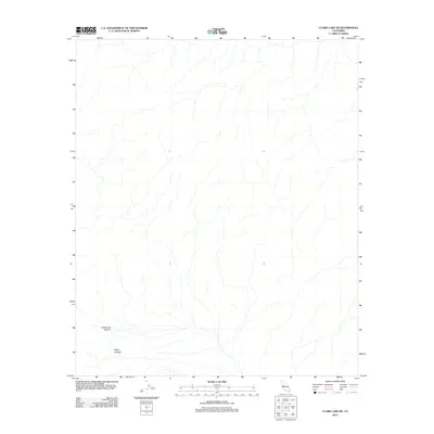
2012 Map of Clark Lake NE
USGS Topo · Published 2012About this map
Rockhouse Canyon and Butler Canyon dominate the southwestern reaches of this California terrain, where drainage patterns define the landscape of San Diego County. This 2012 survey by the U.S. Geological Survey focuses on the complex hydrography of the Clark Lake NE area, recording the seasonal watercourses that have shaped these canyons over generations. The map reveals an environment primarily defined by its natural topography, lacking the dense infrastructure or named settlements found in more developed regions, making it a critical reference for understanding the unmodified drainage basins and geological features of the high desert fringe.
Find a feature on this map
2 named features on this map. Tap any name to fly to it.
Don’t see what you’re looking for? This feature index may not catch every label — zoom into the map to look around manually.
Map Details
Editions of this 2012 Clark Lake NE Map
This is the sole edition of this map. No revisions or reprints were ever made.
Other maps of this area

1904 · Indio
USGS Topo · 1:125,000

1931 · Vallecito
USGS Topo · 1:125,000

1941 · Toro Peak
USGS Topo · 1:62,500

1941 · Clark Lake
USGS Topo · 1:62,500

1941 · Coachella
USGS Topo · 1:62,500

1942 · Agua Dulce
USGS Topo · 1:62,500

1942 · Clark Lake
USGS Topo · 1:62,500

1943 · Vallecito
USGS Topo · 1:125,000

1943 · Coachella
USGS Topo · 1:62,500

1944 · Agua Dulce
USGS Topo · 1:62,500