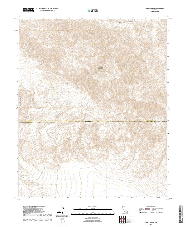
2021 Map of Clark Lake NE
USGS Topo · Published 2021About this map
The Santa Rosa Mountains dominate this high-desert landscape along the border of Riverside and San Diego Counties. This 2021 survey captures the dramatic topography of the region, where the steep grades of Buck Ridge drop into the deep recesses of Rockhouse Canyon and Martinez Canyon. The map reveals a land defined by its natural barriers and drainage patterns, with the northern reaches of Clark Valley visible at the southern edge of the sheet. To the west, the contours of Butler Canyon underscore the isolation and difficult terrain of this part of the California desert. The lack of modern road infrastructure throughout much of this quadrangle emphasizes the area's role as a vast natural corridor between more developed regions of the Colorado Desert and the surrounding mountain ranges.
Find a feature on this map
11 named features on this map. Tap any name to fly to it.
Don’t see what you’re looking for? This feature index may not catch every label — zoom into the map to look around manually.
Map Details
Editions of this 2021 Clark Lake NE Map
This is the sole edition of this map. No revisions or reprints were ever made.
Other maps of this area

1904 · Indio
USGS Topo · 1:125,000

1931 · Vallecito
USGS Topo · 1:125,000

1941 · Toro Peak
USGS Topo · 1:62,500

1941 · Clark Lake
USGS Topo · 1:62,500

1941 · Coachella
USGS Topo · 1:62,500

1942 · Agua Dulce
USGS Topo · 1:62,500

1942 · Clark Lake
USGS Topo · 1:62,500

1943 · Vallecito
USGS Topo · 1:125,000

1943 · Coachella
USGS Topo · 1:62,500

1944 · Agua Dulce
USGS Topo · 1:62,500