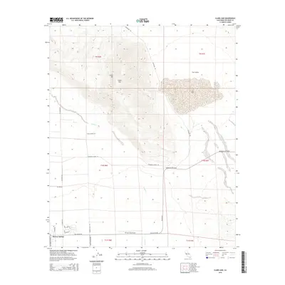
2015 Map of Clark Lake
USGS Topo · Published 2015About this map
The dramatic topography of Coyote Mtn dominates this desert landscape, rising sharply above the flat expanse of Clark Valley. Central to this arid basin is Clark Lake, a prominent seasonal feature that defines the local drainage patterns. The map shows the northward extension of the modern Borrego Springs community, with its residential street grid including Hogan Dr and Palm Canyon Dr terminating near the industrial and transit hub of the Borrego Valley Airport.
Find a feature on this map
25 named features on this map. Tap any name to fly to it.
Don’t see what you’re looking for? This feature index may not catch every label — zoom into the map to look around manually.
Map Details
Editions of this 2015 Clark Lake Map
This is the sole edition of this map. No revisions or reprints were ever made.
Other maps of this area

1904 · Indio
USGS Topo · 1:125,000

1931 · Vallecito
USGS Topo · 1:125,000

1939 · Borrego
USGS Topo · 1:62,500

1941 · Clark Lake
USGS Topo · 1:62,500

1942 · Barrel Spring
USGS Topo · 1:62,500

1942 · Agua Dulce
USGS Topo · 1:62,500

1942 · Clark Lake
USGS Topo · 1:62,500

1942 · Borego
USGS Topo · 1:62,500

1943 · Vallecito
USGS Topo · 1:125,000

1944 · Agua Dulce
USGS Topo · 1:62,500