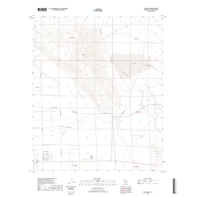
2018 Map of Clark Lake
USGS Topo · Published 2018About this map
Coyote Mtn dominates this arid landscape, rising sharply above the desert floor north of the residential developments near Borrego Valley Airport. This area of San Diego County exhibits a striking contrast between the steep, high relief of the mountains and the flat, sprawling basins of Clark Valley and the seasonal Clark Lake. The map details a network of desert routes and modern infrastructure, from primitive paths like Rockhouse Truck Trl and De Anza Trl to established thoroughfares like Henderson Canyon Rd. Along the southern margin, street names such as Nancy Lopez Dr and Walter Hagan Dr W indicate the area's transition into recreational and residential land use. Water management in this dry climate is evidenced by the drainage patterns of Coyote Creek as it winds toward the valley floor.
Find a feature on this map
27 named features on this map. Tap any name to fly to it.
Don’t see what you’re looking for? This feature index may not catch every label — zoom into the map to look around manually.
Map Details
Editions of this 2018 Clark Lake Map
This is the sole edition of this map. No revisions or reprints were ever made.
Other maps of this area

1904 · Indio
USGS Topo · 1:125,000

1931 · Vallecito
USGS Topo · 1:125,000

1939 · Borrego
USGS Topo · 1:62,500

1941 · Clark Lake
USGS Topo · 1:62,500

1942 · Barrel Spring
USGS Topo · 1:62,500

1942 · Agua Dulce
USGS Topo · 1:62,500

1942 · Clark Lake
USGS Topo · 1:62,500

1942 · Borego
USGS Topo · 1:62,500

1943 · Vallecito
USGS Topo · 1:125,000

1944 · Agua Dulce
USGS Topo · 1:62,500