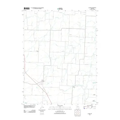
2012 Map of Clark
USGS Topo · Published 2012About this map
The settlement of Clark serves as the primary hub in this central Missouri landscape, where the agricultural grid is defined by a complex network of waterways. Small farm ponds and larger impoundments like Cedarlane Farms Lake and Milnes Lake are scattered across the terrain, supported by structures such as Martin Lake Dam and Hanak Lake Dam. The area is drained by a series of branching systems including Big Creek, Lick Fork, and Saling Creek, which dictate the local topography and road placement. To the north, the small community of Davenport sits near the upper reaches of Reese Fork. For those researching family history in Randolph County, the Mount Pisgah Cemetery provides a significant genealogical landmark, situated along the Pisgah Branch as it flows toward the eastern edge of the survey area.
Find a feature on this map
61 named features on this map. Tap any name to fly to it.
Don’t see what you’re looking for? This feature index may not catch every label — zoom into the map to look around manually.
Map Details
Editions of this 2012 Clark Map
This is the sole edition of this map. No revisions or reprints were ever made.
Other maps of this area

1890 · Moberly
USGS Topo · 1:125,000

1917 · Sturgeon
USGS Topo · 1:62,500

1945 · Centralia
USGS Topo · 1:62,500

1952 · Middle Grove
USGS Topo · 1:24,000

1953 · Moberly
USGS Topo · 1:250,000

1953 · Renick
USGS Topo · 1:24,000

1953 · Clark
USGS Topo · 1:24,000
1953 · Moberly
USGS Topo · 1:24,000

1954 · Moberly
USGS Topo · 1:250,000

1957 · Moberly
USGS Topo · 1:250,000