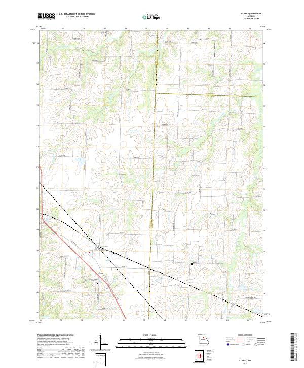
2021 Map of Clark
USGS Topo · Published 2021About this map
The town of Clark serves as the central hub of this agricultural landscape, where the borders of Randolph, Monroe, and Audrain counties converge. A network of country roads including State Hwy NN, State Hwy P, and State Hwy Y connects the surrounding farmsteads to the settlement. The area is defined by the subtle drainage patterns of numerous waterways, notably the Reese Fork and Saling Cr, which move through the fields and woodlots of the Missouri interior.
Find a feature on this map
81 named features on this map. Tap any name to fly to it.
Don’t see what you’re looking for? This feature index may not catch every label — zoom into the map to look around manually.
Map Details
Editions of this 2021 Clark Map
This is the sole edition of this map. No revisions or reprints were ever made.
Other maps of this area

1890 · Moberly
USGS Topo · 1:125,000

1917 · Sturgeon
USGS Topo · 1:62,500

1945 · Centralia
USGS Topo · 1:62,500

1952 · Middle Grove
USGS Topo · 1:24,000

1953 · Moberly
USGS Topo · 1:250,000

1953 · Renick
USGS Topo · 1:24,000

1953 · Clark
USGS Topo · 1:24,000
1953 · Moberly
USGS Topo · 1:24,000

1954 · Moberly
USGS Topo · 1:250,000

1957 · Moberly
USGS Topo · 1:250,000