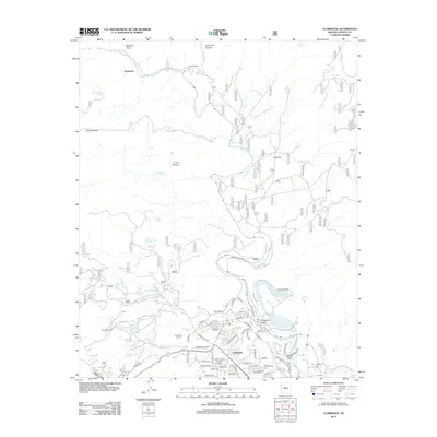
2012 Map of Clarkdale
USGS Topo · Published 2012About this map
The Verde River carves a path through this high desert region, anchoring a landscape defined by mining history and water management. Early industrial activity is evidenced by the Hopewell Tunnel and Josephine Tunnel, while the settlement of Tapco and the neighborhoods of Centerville mark the local residential footprint. The terrain transitions from the deep Sycamore Canyon in the north toward the agricultural and utility infrastructure surrounding Pecks Lake and the Cottonwood Ditch. Numerous isolated water sources, such as Dripping Spring and Mexican Seep, point to the critical role of springs in this arid environment. Genealogy researchers can locate the Valley View Cem and the site of the historic Packard Ranch, providing a window into the family legacies that shaped this portion of Yavapai County.
Find a feature on this map
80 named features on this map. Tap any name to fly to it.
Don’t see what you’re looking for? This feature index may not catch every label — zoom into the map to look around manually.
Map Details
Editions of this 2012 Clarkdale Map
This is the sole edition of this map. No revisions or reprints were ever made.
Other maps of this area

1887 · Verde
USGS Topo · 1:250,000

1887 · Prescott
USGS Topo · 1:250,000

1892 · Verde
USGS Topo · 1:250,000

1892 · Prescott
USGS Topo · 1:250,000

1905 · Jerome
USGS Topo · 1:125,000

1923 · Camp Verde
USGS Topo · 1:125,000

1932 · Camp Verde
USGS Topo · 1:125,000

1936 · Camp Verde
USGS Topo · 1:125,000

1944 · Clarkdale
USGS Topo · 1:48,000

1944 · Mingus Mountain
USGS Topo · 1:62,500