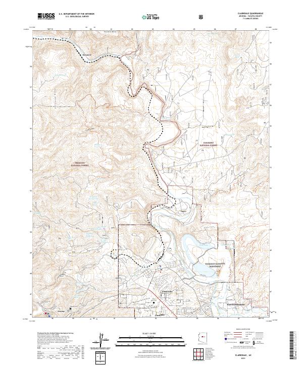
2021 Map of Clarkdale
USGS Topo · Published 2021About this map
Jerome and its industrial heritage anchor the western slopes of this Verde Valley landscape, where mining-era infrastructure like the Hopewell Tunnel and Josephine Tunnel points to the region's copper history. The terrain drops from the Antelope Hills and Packard Mesa toward the Verde River, which winds past the historical industrial site at Tapco and the residential clusters of Centerville and Clarkdale. This alignment of settlements along the river corridor reveals the transition from mountain mining to valley processing and agriculture.
Find a feature on this map
59 named features on this map. Tap any name to fly to it.
Don’t see what you’re looking for? This feature index may not catch every label — zoom into the map to look around manually.
Map Details
Editions of this 2021 Clarkdale Map
This is the sole edition of this map. No revisions or reprints were ever made.
Other maps of this area

1887 · Verde
USGS Topo · 1:250,000

1887 · Prescott
USGS Topo · 1:250,000

1892 · Verde
USGS Topo · 1:250,000

1892 · Prescott
USGS Topo · 1:250,000

1905 · Jerome
USGS Topo · 1:125,000

1923 · Camp Verde
USGS Topo · 1:125,000

1932 · Camp Verde
USGS Topo · 1:125,000

1936 · Camp Verde
USGS Topo · 1:125,000

1944 · Clarkdale
USGS Topo · 1:48,000

1944 · Mingus Mountain
USGS Topo · 1:62,500