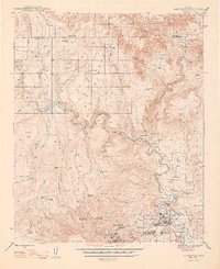
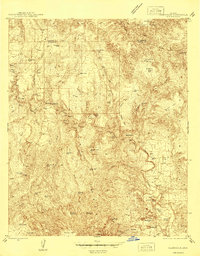
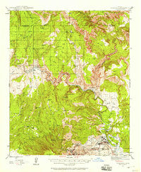
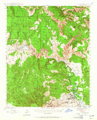
1944 Map of Clarkdale
USGS Topo · Published 1948About this map
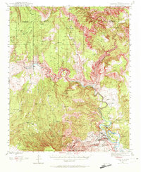
Industrial copper mining and high-desert ranching define this mid-century landscape along the Verde River. The copper operations at Jerome are documented in striking detail, showing the massive United Verde Mine alongside the Hopewell Tunnel and the nearby Smelter. Transportation is anchored by the Atchison Topeka and Santa Fe Railroad, which follows the river's winding course to serve the company towns of Clarkdale and Tapco.
Find a feature on this map
69 named features on this map. Tap any name to fly to it.
Don’t see what you’re looking for? This feature index may not catch every label — zoom into the map to look around manually.
Map Details
Editions of this 1944 Clarkdale Map
5 editions found
Other maps of this area

1886 · San Francisco Mtns
USGS Topo · 1:250,000

1886 · Chino
USGS Topo · 1:250,000

1887 · Verde
USGS Topo · 1:250,000

1887 · Prescott
USGS Topo · 1:250,000

1891 · San Francisco Mtns
USGS Topo · 1:250,000

1891 · Chino
USGS Topo · 1:250,000

1892 · Verde
USGS Topo · 1:250,000

1892 · Prescott
USGS Topo · 1:250,000

1894 · San Francisco Mtns
USGS Topo · 1:250,000

1899 · San Francisco Mtns
USGS Topo · 1:250,000