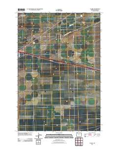
2011 Map of Clarke
USGS Topo · Published 2011About this map
Clarke sits within a sparse high-desert landscape in Morrow County, defined by its critical water sources and transportation corridors. The map highlights the reliance on managed water in this arid region, featuring the West Extension Irrigation Canal and natural points like Coyote Spring and Upper Sand Spring. These water features provided essential relief for early travelers and livestock in a territory where such resources were few and far between.
Find a feature on this map
14 named features on this map. Tap any name to fly to it.
Don’t see what you’re looking for? This feature index may not catch every label — zoom into the map to look around manually.
Map Details
Editions of this 2011 Clarke Map
This is the sole edition of this map. No revisions or reprints were ever made.
Other maps of this area

1906 · Blalock Island
USGS Topo · 1:125,000

1908 · Blalock Island
USGS Topo · 1:125,000

1908 · Umatilla
USGS Topo · 1:125,000

1953 · Pendleton
USGS Topo · 1:250,000

1956 · Pendleton
USGS Topo · 1:250,000

1962 · Blalock Island
USGS Topo · 1:24,000

1962 · Ordnance
USGS Topo · 1:24,000

1962 · Paterson
USGS Topo · 1:24,000

1962 · Boardman
USGS Topo · 1:24,000

1962 · Clarke
USGS Topo · 1:24,000