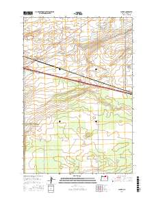
2017 Map of Clarke
USGS Topo · Published 2017About this map
Clarke sits at the intersection of a network of roads and water management features in this part of Morrow County. The landscape is defined by its irrigation infrastructure, most notably the W Extension Irrigation Canal and Boardman Canal Rd, which support the agricultural viability of this dry Oregon terrain. Natural water sources like Upper Sand Spring, Lower Sand Spring, and Coyote Spring are scattered across the township, marking the essential hydrology that predates modern diversion projects. The grid of service and access roads, including Paterson Ferry Rd and the heavily named Bombing Range Rd along the western edge, illustrates a late-20th-century transition toward organized land management and regional connectivity in the Columbia Basin region.
Find a feature on this map
20 named features on this map. Tap any name to fly to it.
Don’t see what you’re looking for? This feature index may not catch every label — zoom into the map to look around manually.
Map Details
Editions of this 2017 Clarke Map
This is the sole edition of this map. No revisions or reprints were ever made.
Other maps of this area

1906 · Blalock Island
USGS Topo · 1:125,000

1908 · Blalock Island
USGS Topo · 1:125,000

1908 · Umatilla
USGS Topo · 1:125,000

1953 · Pendleton
USGS Topo · 1:250,000

1956 · Pendleton
USGS Topo · 1:250,000

1962 · Blalock Island
USGS Topo · 1:24,000

1962 · Ordnance
USGS Topo · 1:24,000

1962 · Paterson
USGS Topo · 1:24,000

1962 · Boardman
USGS Topo · 1:24,000

1962 · Clarke
USGS Topo · 1:24,000