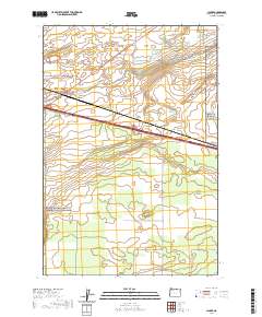
2020 Map of Clarke
USGS Topo · Published 2020About this map
Clarke sits at the nexus of water management and transportation in this high desert landscape of Morrow County. The area’s reliance on groundwater and engineering is evident through the presence of Upper Sand Spring, Lower Sand Spring, and Coyote Spring, which historically supported life in this arid region. The W Extension Irrigation Canal cuts across the northern terrain, following the alignment of Boardman Canal Rd, illustrating the complex network of water rights and infrastructure essential for local agriculture.
Find a feature on this map
21 named features on this map. Tap any name to fly to it.
Don’t see what you’re looking for? This feature index may not catch every label — zoom into the map to look around manually.
Map Details
Editions of this 2020 Clarke Map
This is the sole edition of this map. No revisions or reprints were ever made.
Other maps of this area

1906 · Blalock Island
USGS Topo · 1:125,000

1908 · Blalock Island
USGS Topo · 1:125,000

1908 · Umatilla
USGS Topo · 1:125,000

1953 · Pendleton
USGS Topo · 1:250,000

1956 · Pendleton
USGS Topo · 1:250,000

1962 · Blalock Island
USGS Topo · 1:24,000

1962 · Ordnance
USGS Topo · 1:24,000

1962 · Paterson
USGS Topo · 1:24,000

1962 · Boardman
USGS Topo · 1:24,000

1962 · Clarke
USGS Topo · 1:24,000