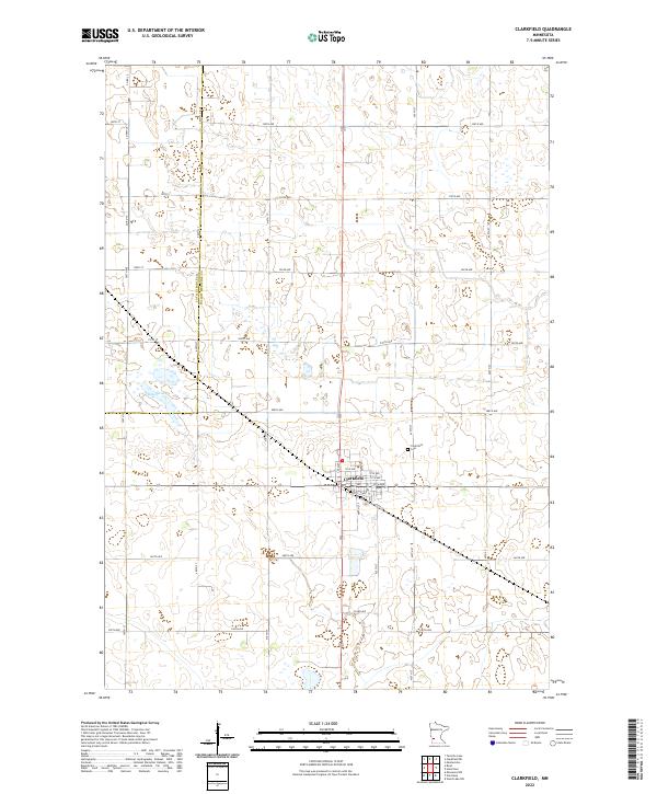
2022 Map of Clarkfield
USGS Topo · Published 2022About this map
Clarkfield serves as the primary hub of this agricultural landscape in Yellow Medicine County, situated at the intersection of several key local routes including Co Rd 24 and Co Hwy 35. The town's grid is clearly defined, with streets such as 8th St and Tenth St S radiating from its center, while the Clarkfield Cem sits just to the northeast of the main settlement.
Find a feature on this map
39 named features on this map. Tap any name to fly to it.
Don’t see what you’re looking for? This feature index may not catch every label — zoom into the map to look around manually.
Map Details
Editions of this 2022 Clarkfield Map
This is the sole edition of this map. No revisions or reprints were ever made.
Other maps of this area

1953 · New Ulm
USGS Topo · 1:250,000

1957 · New Ulm
USGS Topo · 1:250,000

1958 · New Ulm
USGS Topo · 1:250,000

1962 · Wood Lake NW
USGS Topo · 1:24,000

1965 · Montevideo
USGS Topo · 1:24,000

1965 · Clarkfield
USGS Topo · 1:24,000
1965 · Clarkfield NE
USGS Topo · 1:24,000
1965 · Tenmile Lake
USGS Topo · 1:24,000

1965 · Hazel Run
USGS Topo · 1:24,000

1965 · Boyd
USGS Topo · 1:24,000