
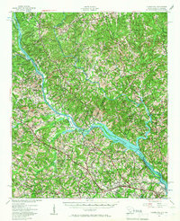
1941 Map of Clarks Hill
USGS Topo · Published 1957About this map
The Savannah River serves as the primary artery for this 1941 survey, marking the state boundary between South Carolina and Georgia before the major reservoir developments of the late 20th century. Numerous ferries like Gilchrist Ferry and Denis Ferry still appear as vital crossing points, while islands such as Price Island and Germain Island dot the river channel. The landscape is defined by its agrarian and industrial infrastructure, with the Charleston and Western Carolina RR and the Georgia and Florida RR connecting settlements like Evans, Martinez, and Clarks Hill. Social life of the era is anchored by numerous rural institutions, including Red Oak Grove Sch, Poplar Springs Ch, and Republican Ch, while the transition to an industrial economy is visible at locations like Griffith Siding.
Find a feature on this map
58 named features on this map. Tap any name to fly to it.
Don’t see what you’re looking for? This feature index may not catch every label — zoom into the map to look around manually.
Map Details
Editions of this 1941 Clarks Hill Map
2 editions found
Other maps of this area

1892 · Mc Cormick
USGS Topo · 1:125,000

1912 · Mc Cormick
USGS Topo · 1:125,000

1920 · Clarks Hill
USGS Topo · 1:48,000

1921 · Augusta
USGS Topo · 1:62,500

1921 · Clarks Hill
USGS Topo · 1:62,500

1921 · Appling
USGS Topo · 1:62,500

1922 · Harlem
USGS Topo · 1:62,500

1922 · Hephzibah
USGS Topo · 1:62,500

1923 · Warrenville
USGS Topo · 1:48,000

1928 · Warrenville
USGS Topo · 1:62,500