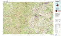
1982 Map of Clarksburg
USGS Topo · Published 1983About this map
Clarksburg stands as the central hub of this North Central West Virginia landscape, situated at the confluence of Elk Creek and the West Fork River. The region’s 1980s industrial character is defined by a dense network of Coal Mine symbols and a wide Gas and Oil Field stretching across the western terrain. Transportation corridors follow the deep valleys of the Appalachian Mountains, with the Baltimore and Ohio Railroad and Interstate 79 facilitating movement between established towns like Buckhannon, Grafton, and Fairmont.
Find a feature on this map
599 named features on this map. Tap any name to fly to it.
Don’t see what you’re looking for? This feature index may not catch every label — zoom into the map to look around manually.
Map Details
Editions of this 1982 Clarksburg Map
This is the sole edition of this map. No revisions or reprints were ever made.
Other maps of this area

1886 · St. George
USGS Topo · 1:125,000

1889 · Beverly
USGS Topo · 1:125,000

1891 · St. George
USGS Topo · 1:125,000

1892 · Beverly
USGS Topo · 1:125,000

1893 · Buckhannon
USGS Topo · 1:125,000

1893 · Sutton
USGS Topo · 1:125,000

1896 · Buckhannon
USGS Topo · 1:125,000

1897 · Buckhannon
USGS Topo · 1:125,000

1902 · Clarksburg
USGS Topo · 1:62,500

1902 · Fairmont
USGS Topo · 1:62,500