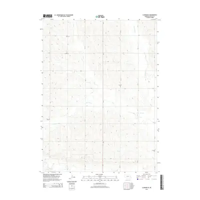
2014 Map of Clarkson SE
USGS Topo · Published 2014About this map
Colfax County's agricultural landscape is defined by a dense network of sectional roads and the serpentine drainages of the Shell Creek and W Fork Maple Cr basins. This 2014 survey captures a rural territory where local heritage is preserved in numerous family and community burial grounds, such as Saint Johns Cem and Sousek Cem. The reliance on local water management is evident in the inclusion of the Kasal Canal and several branches of Dry Cr, including the S Fork Dry Cr. Significant for genealogists and local historians, the map documents the exact positions of Dry Creek Cem, Tollman Cem, and Grandview Cem, providing a detailed spatial record of the county's established rural cemeteries alongside its contemporary highway network, including Ne-15.
Find a feature on this map
30 named features on this map. Tap any name to fly to it.
Don’t see what you’re looking for? This feature index may not catch every label — zoom into the map to look around manually.
Map Details
Editions of this 2014 Clarkson SE Map
This is the sole edition of this map. No revisions or reprints were ever made.
Other maps of this area

1899 · Wahoo
USGS Topo · 1:125,000

1899 · David City
USGS Topo · 1:125,000

1955 · Fremont
USGS Topo · 1:250,000

1957 · Fremont
USGS Topo · 1:250,000

1958 · Fremont
USGS Topo · 1:250,000

1966 · Clarkson SW
USGS Topo · 1:24,000

1966 · Clarkson
USGS Topo · 1:24,000

1966 · Dodge SW
USGS Topo · 1:24,000
1966 · Dodge
USGS Topo · 1:24,000
1966 · Leigh
USGS Topo · 1:24,000