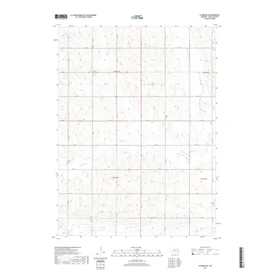
2017 Map of Clarkson SE
USGS Topo · Published 2017About this map
Shell Creek and its various tributaries define the rural landscape of Colfax County in this 2017 survey. The region is marked by a network of sectional roads and a high concentration of family and community burial grounds, including Saint Johns Cem and Sousek Cem in the northern townships. This distribution of small cemeteries like Tollman Cem and Grandview Cem indicates the long-standing agricultural settlement patterns of the area, where rural congregations and families established sites on elevated ground near the various drainages.
Find a feature on this map
41 named features on this map. Tap any name to fly to it.
Don’t see what you’re looking for? This feature index may not catch every label — zoom into the map to look around manually.
Map Details
Editions of this 2017 Clarkson SE Map
This is the sole edition of this map. No revisions or reprints were ever made.
Other maps of this area

1899 · Wahoo
USGS Topo · 1:125,000

1899 · David City
USGS Topo · 1:125,000

1955 · Fremont
USGS Topo · 1:250,000

1957 · Fremont
USGS Topo · 1:250,000

1958 · Fremont
USGS Topo · 1:250,000

1966 · Clarkson SW
USGS Topo · 1:24,000

1966 · Clarkson
USGS Topo · 1:24,000

1966 · Dodge SW
USGS Topo · 1:24,000
1966 · Dodge
USGS Topo · 1:24,000
1966 · Leigh
USGS Topo · 1:24,000