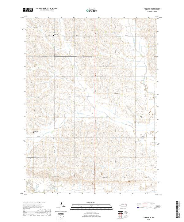
2021 Map of Clarkson SE
USGS Topo · Published 2021About this map
The rolling plains of eastern Nebraska are defined here by a network of creeks and small family-named cemeteries. Several burial grounds, including Sousek Cem and Saint Johns Cem in the northern section, provide valuable location data for genealogists tracing early farming families in Colfax County. The landscape is deeply tied to its water sources, with the W Fork Maple Cr and Shell Creek cutting through the agricultural grid. Human modification of the drainage is visible through the Kasal Canal and the controlled paths of Dry Cr and S Fork Dry Cr. This area remains largely rural, dominated by section-line roads and scattered farmsteads that have persisted since the early settlement era. The inclusion of sites like Dry Creek Cem and Grandview Cem suggests a community landscape anchored by these quiet landmarks.
Find a feature on this map
40 named features on this map. Tap any name to fly to it.
Don’t see what you’re looking for? This feature index may not catch every label — zoom into the map to look around manually.
Map Details
Editions of this 2021 Clarkson SE Map
This is the sole edition of this map. No revisions or reprints were ever made.
Other maps of this area

1899 · Wahoo
USGS Topo · 1:125,000

1899 · David City
USGS Topo · 1:125,000

1955 · Fremont
USGS Topo · 1:250,000

1957 · Fremont
USGS Topo · 1:250,000

1958 · Fremont
USGS Topo · 1:250,000

1966 · Clarkson SW
USGS Topo · 1:24,000

1966 · Clarkson
USGS Topo · 1:24,000

1966 · Dodge SW
USGS Topo · 1:24,000
1966 · Dodge
USGS Topo · 1:24,000
1966 · Leigh
USGS Topo · 1:24,000