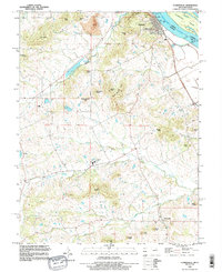
1993 Map of Clarksville
USGS Topo · Published 1996About this map
Mississippi River commerce and the high knobs of the Missouri river bluffs define this landscape, anchored by the river town of Clarksville. The 1990s terrain is heavily marked by industrial and navigational infrastructure, notably the Lock and Dam No 24 and an adjacent Sewage Disposal Pond. Inland, the topographic relief is characterized by numerous named peaks such as The Pinnacle, Robert Hill, and Richardson Knob, which separate the various drainages of Calumet Creek and Fox Creek.
Find a feature on this map
40 named features on this map. Tap any name to fly to it.
Don’t see what you’re looking for? This feature index may not catch every label — zoom into the map to look around manually.
Map Details
Editions of this 1993 Clarksville Map
This is the sole edition of this map. No revisions or reprints were ever made.
Other maps of this area

1890 · Louisiana
USGS Topo · 1:125,000

1930 · Nebo
USGS Topo · 1:62,500

1934 · Nebo
USGS Topo · 1:48,000

1934 · Elsberry
USGS Topo · 1:48,000

1937 · Silex
USGS Topo · 1:62,500

1937 · Bowling Green
USGS Topo · 1:62,500

1939 · Silex
USGS Topo · 1:48,000

1940 · Bowling Green
USGS Topo · 1:62,500

1942 · Nebo
USGS Topo · 1:62,500

1942 · Elsberry
USGS Topo · 1:62,500