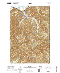
2020 Map of Clatskanie
USGS Topo · Published 2020About this map
Clatskanie serves as the focal point of this northern Oregon landscape, situated where the Clatskanie River meanders toward its confluence with the Columbia River. The town is flanked by high ground to the south, rising toward Clatskanie Heights and the higher elevations of the Coast Range, including notable peaks like Windy Mtn and Benson Point. The settlement pattern reflects a deeply rooted local history, marked by a high density of burial grounds such as Maplewood Cem, Murray Hill Cem, and Bryant Cem, which suggest generations of family residence in the river valley. To the south, the terrain becomes more isolated near the community of Mist, where Mist Cem and numerous creek drainages like Messing Cr and Mud Fork define the timbered landscape. The intricate network of rural roads, such as Clatskanie Valley Rd, follows the natural contours established by the region's complex system of ridges and waterways.
Find a feature on this map
90 named features on this map. Tap any name to fly to it.
Don’t see what you’re looking for? This feature index may not catch every label — zoom into the map to look around manually.
Map Details
Editions of this 2020 Clatskanie Map
This is the sole edition of this map. No revisions or reprints were ever made.
Other maps of this area

1919 · Mayger
USGS Topo · 1:62,500

1940 · Vernonia
USGS Topo · 1:62,500

1941 · Keasey
USGS Topo · 1:62,500

1941 · Clatskanie
USGS Topo · 1:62,500

1941 · Cathlamet
USGS Topo · 1:62,500

1943 · Vernonia
USGS Topo · 1:62,500

1943 · Keasey
USGS Topo · 1:62,500

1948 · Vancouver
USGS Topo · 1:250,000

1950 · Vancouver
USGS Topo · 1:250,000

1950 · Vancouver
USGS Topo · 1:250,000