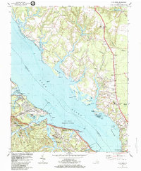
1984 Map of Clay Bank
USGS Topo · Published 1984About this map
The York River dominates this mid-1980s landscape, serving as the dividing line between extensive military installations and the historic tidewater settlements of Gloucester County. On the southern shore, the U S Naval Supply Center Cheatham Annex and the US Naval Weapons Station occupy the peninsula, where researchers can find the Bellfield Plantation Site tucked between modern infrastructure like the Colonial National Historical Parkway. Across the water, the topography transitions into a network of creeks and marshes, including Pine Swamp and Coleman Swamp.
Find a feature on this map
71 named features on this map. Tap any name to fly to it.
Don’t see what you’re looking for? This feature index may not catch every label — zoom into the map to look around manually.
Map Details
Editions of this 1984 Clay Bank Map
3 editions found
Other maps of this area

1906 · Williamsburg
USGS Topo · 1:62,500

1907 · Yorktown
USGS Topo · 1:62,500

1907 · Hampton
USGS Topo · 1:62,500

1916 · Mathews
USGS Topo · 1:62,500

1917 · Mathews
USGS Topo · 1:62,500

1943 · Yorktown
USGS Topo · 1:62,500

1943 · Richmond
USGS Topo · 1:250,000

1944 · Yorktown
USGS Topo · 1:24,000

1944 · Harris Grove
USGS Topo · 1:24,000

1948 · Ware Neck
USGS Topo · 1:24,000