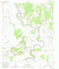
1959 Map of Clay
USGS Topo · Published 1980About this map
Clay stands as a focal point near the confluence of major Texas waterways, where the Brazos River meets Yegua Creek at the county boundaries of Burleson, Brazos, and Washington. This mid-century landscape is defined by the winding meanders of the Brazos, including the prominent Big Bend, and a network of bayous and creeks like Koontz Bayou and Boggy Creek. The region’s infrastructure is shaped by its rail history, featuring the Gulf Colorado and Santa Fe and the Texas and New Orleans (SP) lines, alongside a legacy of industrial extraction noted by the Clay Pit and various Gravel Pits. Local genealogy is well-preserved through several burial sites, including Botts Ferry Cem, Clay Cem, and Thomas Cem. The map also records oxbow formations such as Clay Lake and Tennessee Lake, which illustrate the river's historical shifts through the bottomlands.
Find a feature on this map
26 named features on this map. Tap any name to fly to it.
Don’t see what you’re looking for? This feature index may not catch every label — zoom into the map to look around manually.
Map Details
Editions of this 1959 Clay Map
3 editions found
Other maps of this area

1913 · Millican
USGS Topo · 1:31,680

1914 · Gay Hill
USGS Topo · 1:62,500

1914 · Navasota
USGS Topo · 1:62,500

1954 · Austin
USGS Topo · 1:250,000

1956 · Bryan
USGS Topo · 1:62,500

1956 · Carlos
USGS Topo · 1:62,500

1958 · Washington
USGS Topo · 1:24,000

1959 · Millican
USGS Topo · 1:24,000

1959 · Gay Hill
USGS Topo · 1:24,000

1959 · Clay
USGS Topo · 1:24,000