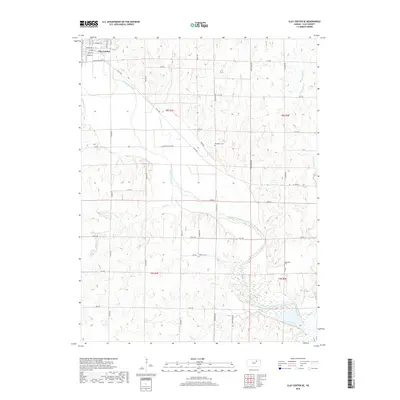
2018 Map of Clay Center SE
USGS Topo · Published 2018About this map
Clay Center anchors the northwest corner of this agricultural landscape, where a grid of residential streets including Sherman St and Maple St meets the open country. The Republican River winds diagonally across the terrain, joined by several tributaries such as Lincoln Cr and Otter Cr. This river system creates a complex drainage pattern through the sections of Clay County, influencing the placement of local roads and land use. Rural burial grounds including Broughton Cem, Gilbert Cem, and Gatesville Cem are preserved among the fields, serving as vital landmarks for genealogists tracing families in the T8S and T9S townships. The land south of the river is characterized by the meandering Cane Creek and Mall Cr, illustrating the well-watered nature of these central Kansas plains.
Find a feature on this map
45 named features on this map. Tap any name to fly to it.
Don’t see what you’re looking for? This feature index may not catch every label — zoom into the map to look around manually.
Map Details
Editions of this 2018 Clay Center SE Map
This is the sole edition of this map. No revisions or reprints were ever made.
Other maps of this area

1886 · Junction City
USGS Topo · 1:125,000

1889 · Junction City
USGS Topo · 1:125,000

1891 · Clay Center
USGS Topo · 1:125,000

1894 · Junction City
USGS Topo · 1:125,000

1947 · Fort Riley
USGS Topo · 1:62,500

1951 · Milford
USGS Topo · 1:24,000

1955 · Milford
USGS Topo · 1:24,000

1955 · Manhattan
USGS Topo · 1:250,000

1956 · Manhattan
USGS Topo · 1:250,000

1957 · Manhattan
USGS Topo · 1:250,000