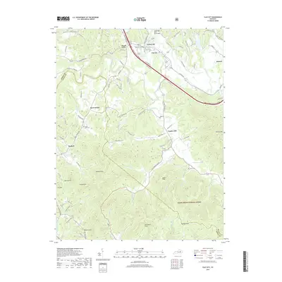
2019 Map of Clay City
USGS Topo · Published 2019About this map
Clay City and Stanton anchor this topographic view of the Red River valley, where the winding watercourse carves a path through the northern reaches of the Daniel Boone National Forest. The landscape is defined by the sharp contrast between the valley floor settlements and the high ridges and knobs to the south. Modern infrastructure like the Bert T Combs Mountain Parkway follows the natural drainage of the Red River, connecting historically distinct hamlets such as Waltersville, Powell Valley, and Vaughns Mill. Local family history is preserved in small burial grounds scattered throughout the hills, including Clark Cem, Jackson Chapel Cem, and Kennon Cem. Significant elevation changes are marked by landmarks like Buzzard Roost, Grassy Knob, and McKinney Mtn, illustrating the transition from river bottomlands to the complex topography of Marbleyard Ridge.
Find a feature on this map
103 named features on this map. Tap any name to fly to it.
Don’t see what you’re looking for? This feature index may not catch every label — zoom into the map to look around manually.
Map Details
Editions of this 2019 Clay City Map
This is the sole edition of this map. No revisions or reprints were ever made.
Other maps of this area

1892 · Richmond
USGS Topo · 1:125,000

1892 · Beattyville
USGS Topo · 1:125,000

1897 · Richmond
USGS Topo · 1:125,000

1950 · Levee
USGS Topo · 1:24,000

1952 · Palmer
USGS Topo · 1:24,000

1952 · Clay City
USGS Topo · 1:24,000

1952 · Stanton
USGS Topo · 1:24,000

1952 · Means
USGS Topo · 1:24,000

1952 · Levee
USGS Topo · 1:24,000

1952 · Cobhill
USGS Topo · 1:24,000