
1908 Map of Clay
USGS Topo · Published 1908About this map
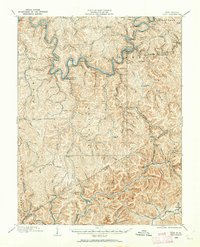
Elk River defines the industrial and residential geography of central West Virginia in 1908, winding past riverfront settlements and early rail junctions. The Coal And Coke Rr follows the river's path, connecting hubs like Shelley Junction and Elkhurst to the region's expanding timber and mineral interests. Away from the main river valley, the landscape is dotted with small hilltop and hollow communities, often centered around institutions like Rosetta School, Triplett School, and the Pisgah Ch. The presence of the Lumber Rail Road in the southern hills indicates an era of heavy forest extraction, with numerous family-named landmarks like Schoonover Knob and Bird Knob marking the terrain. Notable post offices, including Camp Precious PO and Big Sycamore Eldorado PO, provide essential links for residents in these developing mountain watersheds.
Find a feature on this map
163 named features on this map. Tap any name to fly to it.
Don’t see what you’re looking for? This feature index may not catch every label — zoom into the map to look around manually.
Map Details
Editions of this 1908 Clay Map
2 editions found
Other maps of this area

1889 · Nicholas
USGS Topo · 1:125,000

1891 · Nicholas
USGS Topo · 1:125,000

1893 · Sutton
USGS Topo · 1:125,000

1897 · Kanawha Falls
USGS Topo · 1:125,000

1900 · Kanawha Falls
USGS Topo · 1:125,000

1901 · Nicholas
USGS Topo · 1:125,000

1901 · Kanawha Falls
USGS Topo · 1:125,000

1906 · Otter
USGS Topo · 1:62,500

1906 · Walton
USGS Topo · 1:62,500

1907 · Otter
USGS Topo · 1:62,500