
1954 Map of Clay Hills 2 SE
USGS Topo · Published 1955About this map
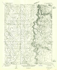
The San Juan River snakes through the center of this 1954 survey, defining a dramatic canyon landscape in San Juan County. Much of the southern half of the map lies within the Navajo Indian Reservation, where the terrain transitions from high plateaus to deep, winding drainages. The mapping, based on 1952 aerial photography, documents a nearly uninhabited territory characterized by complex hydrology and extreme vertical relief. Minor water features such as Nancys Pool and a remote Reservoir indicate the critical importance of water management in this arid environment. The presence of Whirlwind Draw illustrates the intricate system of canyons and seasonal washes that feed into the main river channel, revealing a landscape shaped by erosion and geological isolation before modern infrastructure altered the region.
Find a feature on this map
5 named features on this map. Tap any name to fly to it.
Don’t see what you’re looking for? This feature index may not catch every label — zoom into the map to look around manually.
Map Details
Editions of this 1954 Clay Hills 2 SE Map
This is the sole edition of this map. No revisions or reprints were ever made.
Other maps of this area

1886 · Henry Mountains
USGS Topo · 1:250,000

1892 · Henry Mountains
USGS Topo · 1:250,000

1952 · Clay Hills 3 NW
USGS Topo · 1:24,000

1952 · Oljeto
USGS Topo · 1:62,500

1954 · Clay Hills 2 SW
USGS Topo · 1:24,000

1954 · Clay Hills 2 NW
USGS Topo · 1:24,000
1954 · Clay Hills 3 NE
USGS Topo · 1:24,000

1954 · Clay Hills 2 NE
USGS Topo · 1:24,000

1954 · Clay Hills 1 NW
USGS Topo · 1:24,000
1954 · Clay Hills
USGS Topo · 1:62,500