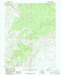
1987 Map of Clay Hills
USGS Topo · Published 1987About this map
The Red House Cliffs dominate this 1980s landscape in San Juan County, where the high desert terrain transitions between the dramatic elevation of the Clay Hills and the deep incisions of Moqui Canyon. This provisional survey records a network of vital water sources in a characteristically arid environment, including Irish Green Spring and Green Water Spring, which likely supported the small-scale ranching operations evidenced by the Corral near the cliffs. The geography is further defined by the Clay Hills Divide, a prominent natural landmark that separates drainage basins such as Steer Creek and the southern reaches of Mikes Canyon. Evidence of mineral exploration appears in the form of scattered Prospects, while a series of 4wd tracks provides the primary means of traversing the steep slopes of Whirlwind Draw and the Steer Pasture.
Find a feature on this map
14 named features on this map. Tap any name to fly to it.
Don’t see what you’re looking for? This feature index may not catch every label — zoom into the map to look around manually.
Map Details
Editions of this 1987 Clay Hills Map
This is the sole edition of this map. No revisions or reprints were ever made.
Other maps of this area

1886 · Henry Mountains
USGS Topo · 1:250,000

1892 · Henry Mountains
USGS Topo · 1:250,000

1952 · Mancos Mesa
USGS Topo · 1:62,500

1952 · Natural Bridges
USGS Topo · 1:62,500

1954 · White Canyon 3 SE
USGS Topo · 1:24,000

1954 · White Canyon 4 SW
USGS Topo · 1:24,000

1954 · White Canyon 3 SW
USGS Topo · 1:24,000

1954 · Clay Hills 2 SW
USGS Topo · 1:24,000

1954 · Clay Hills 2 NW
USGS Topo · 1:24,000

1954 · Clay Hills 2 NE
USGS Topo · 1:24,000