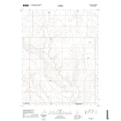
2020 Map of Clay Point
USGS Topo · Published 2020About this map
Burr Trl snakes through this high desert terrain, marking a primary route through the canyon-and-plateau landscape of Garfield County. The geography is defined by prominent topographical elevations including Hall Mesa, Clay Point, and Saleratus Point, which look down upon a drainage network shaped by Saleratus Wash, Bullfrog Cr, and Thompson Cr. This land is a critical meeting point of preserved federal wilderness, where the southern reaches of Capitol Reef National Park border the Glen Canyon National Recreation Area. The intricate system of steep-walled drainages like Fourmile Canyon, Clay Canyon, and Long Canyon demonstrates the characteristic erosional patterns of the Colorado Plateau, while landmarks such as Dials Knob and Middle Point provide distinct navigational markers in a region where few paved improvements exist beyond the primary trail.
Find a feature on this map
14 named features on this map. Tap any name to fly to it.
Don’t see what you’re looking for? This feature index may not catch every label — zoom into the map to look around manually.
Map Details
Editions of this 2020 Clay Point Map
This is the sole edition of this map. No revisions or reprints were ever made.
Other maps of this area

1886 · Henry Mountains
USGS Topo · 1:250,000

1892 · Henry Mountains
USGS Topo · 1:250,000

1952 · Mt Pennell 1 SW
USGS Topo · 1:24,000

1952 · Mt Hillers
USGS Topo · 1:62,500

1953 · Mt Pennell
USGS Topo · 1:62,500

1953 · Mt Pennell 2 SE
USGS Topo · 1:24,000

1953 · Mt Pennell 3 NW
USGS Topo · 1:24,000

1953 · Mt Pennell 3 SW
USGS Topo · 1:24,000

1953 · Mt Pennell 2 SW
USGS Topo · 1:24,000

1953 · Mt. Ellsworth
USGS Topo · 1:62,500